|
|
|
|
How To Get To And From Our Walks
|
|
|
All of our walks are designed to be easily accessible to as many people as possible. As an environmentally-responsible business, we also encourage our customers to use public transport where possible to access our walks, and the start and finish points of each walk are located close to either a bus stop or a railway station (sometimes both). The start times of the walks are also timed to coincide with the arrival of a convenient bus or train service, with an allowance made for any possible delays.
However, we also recognise that it may not always be possible or convenient to use public transport, especially for those of limited mobility, so we also try to locate the start and finish points within reasonable walking distance of a public car park. |
|
|
On this page, we hope to provide you with the most up-to-date information about all of the means by which you can access our walks. In addition to local car parks close to each walk, you can also find information about which buses and trains you can use to access each walk. Not only does this include which services to use, but also information about where to get on and off, and how far you need to walk after getting off.
When you book a walk, you will receive an information sheet that gives you detailed travel instructions, including public transport times and recommended driving routes. While these driving routes may vary from what your sat-nav or online route planner may tell you, these routes have been worked out using local knowledge and experience, taking into account factors that sat-nav and online app programmers may not have access to.
|
|
Please note that, while we try to keep this page as up-to-date as possible, there may be instances where we are not made aware of changes to services at the time they occur. For this reason, we recommend that you always check bus and train times with the relevant operator before travelling. Detailed up-to-date information on the times of all bus services operating within Derbyshire can be found here, while information on train services and fares can be found here.
|
|
Walks Beginning Or Ending In:
|
||||||||
Ashford-in-the-Water |
Bakewell |
Belper |
Brierlow Bar & Hartington |
Buxton |
Cromford |
Edale |
Miller's Dale & Wyedale |
Taddington |
|
Walks Beginning In Ashford-in-the-Water
|
|
Public Transport
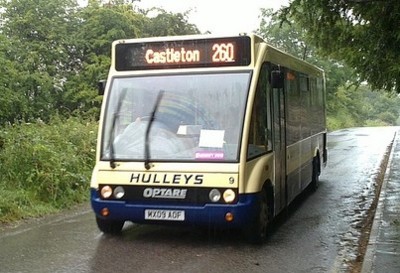
The village of Ashford-in-the-Water is quite easy to access by public transport, as it is served by the hourly High Peak Buses "Transpeak" service running between Derby and Buxton. Besides Derby and Buxton, the buses also call at Belper, Cromford, Matlock Bath and Matlock. To access Ashford-in-the-Water from Manchester, take one of the regular train services from Manchester Piccadilly to Buxton, and change to the "Transpeak" outside Buxton Station. Unfortunately, using the train isn't really an option for Sundays and Bank Holidays, as the first train (which is currently operated as a rail replacement bus) does not arrive into Buxton in time to connect with the "Transpeak". As a result, Ashford-in-the-Water is difficult to access by public transport from Manchester on Sundays. If travelling from Sheffield, Ashford-in-the-Water can be reached by taking the TM Travel 218 bus service from Sheffield to Bakewell, changing there to the "Transpeak" to Ashford-in-the-Water. From Chesterfield, take the Hulleys of Baslow 170 bus service to Bakewell. If this bus arrives into Bakewell on time, you would then have around four minutes to make a connection with the "Transpeak" to Ashford-in-the-Water. However, you may be much better off changing to the Hulleys of Baslow 173 bus service towards Tideswell. This calls at a stop on New Road in Ashford-in-the-Water, and you then have a walk of about 5 minutes through the village to reach the start point of your walk. At weekends, there is a longer gap between the arrival of the 170 service and the departure of the "Transpeak", making this a more viable option. Car Parking in Ashford-in-the-Water Ashford-in-the-Water only has one very small public car park. However, as this only has around 8 spaces, it is usually full and so not really an option. As none of our scheduled walks finish in the village, you would also need to use the bus to get back there in order to collect your car. As a result, it is much more practical to park in Bakewell, in either the Bakewell Bridge or Agricultural Centre car parks, and use the "Transpeak" to get to Ashford-in-the-Water for the start of your walk there. |
|
|
|
Walks Beginning/Ending In Bakewell
|
|
Public Transport
Located on the main A6 Derby to Buxton and Manchester road, Bakewell is quite easy to access via public transport. There are two main bus services operating along the A6 through Bakewell, the Trent Barton 6.1 service from Derby to Bakewell, and the High Peak Buses "Transpeak" express service between Derby and Buxton. Both of these operate hourly during the day on weekdays Saturdays, Sundays and Bank Holidays. Along their route, they also call at Belper, Cromford, Matlock Bath and Matlock, with the 6.1 also calling at Wirksworth. It is also possible to access Bakewell by bus from Sheffield on the TM Travel 218 service, and from Chesterfield via the Hulleys of Baslow 170 bus service. Bakewell can be accessed by public transport from Manchester by taking the train from Manchester Piccadilly Station to Buxton, and then taking the "Transpeak" from the stop outside Buxton Station to Bakewell. Unfortunately, using the train isn't really an option for Sundays and Bank Holidays, as the first train does not arrive into Buxton in time to connect with the bus. At the end of a walk terminating in Bakewell, you can use either the "Transpeak" or Trent Barton 6.1 services to return home to Matlock, Belper or Derby. These both depart hourly from the stop on Matlock Street. If you need to return to Chesterfield or Sheffield from Bakewell at the end of your walk, then the Hulleys of Baslow 170 and X70 services run regularly between Bakewell and Chesterfield, while the TM Travel 218 service runs regularly between Bakewell and Sheffield. It is also possible to use the "Transpeak" to return to Manchester by changing to the train at Buxton. The Derbyshire Wayfarer day rover ticket is valid on all of the buses listed above. More information on the validity of the Derbyshire Wayfarer ticket can be found here. If travelling from Manchester, it is possible to use the Greater Manchester Wayfarer day rover ticket on all bus and train services to and from Buxton and Manchester, including the "Transpeak" to or from Bakewell. Car Parking in Bakewell By far the most convenient car park in Bakewell for most of our walks beginning or ending there is at Bakewell Station. This is a 28-space pay-and-display car park operated by the Peak District National park, and is conveniently located right next to the Bakewell end of the Monsal Trail. Unfortunately this does mean that, on busy days, it can be a problem finding a space, so you may need to use the larger car park by Bakewell Bridge instead. If you are travelling by car, the walk information sheet you will be sent along with your booking confirmation will contain advice on the best places to park and what public transport we recommend you use in order to collect your car at the end of your walk. |
|
|
|
Walks Beginning/Ending In Belper
|
|
Public Transport
Situated just 8 miles north of Derby, Belper is very well served by public transport. In addition to the hourly train services between Matlock, Derby, Nottingham and Newark, the town is also served by a number of bus services from Derby, Ripley, Wirksworth, Matlock, Bakewell and Buxton. From Derby, Trent Barton operate six buses every hour along the A6 as part of their "Sixes" network, with buses departing Derby every ten minutes. All of these buses can be used to return to Ripley, Derby, Wirksworth, Matlock or Bakewell at the end of your walk. Please note that Sunday and Bank Holiday services on the "Sixes" are limited, with a reduced frequency of service and some routes not served at all. Another regular bus service through Belper is the hourly High Peak Buses "Transpeak" service between Derby and Buxton via Bakewell and Matlock. Belper is also accessible from Ashbourne via the regular High Peak Buses 113 service, which can also be used to return to Ashbourne at the end of your walk. This service runs Mondays to Saturdays, with no Sunday or Bank Holiday service. Please note that the weekday service that allows access to walks starting at 10:00am only operates during school term times. Outside of school terms, the first bus does not depart from Ashbourne in time to access these walks. The trains through Belper are operated by East Midlands Railway, and run hourly on weekdays and Saturdays between Matlock and Newark via Derby and Nottingham. On Sundays and Bank Holidays, the services are more limited, and usually run every two hours from late morning onwards. The Derbyshire Wayfarer day rover ticket is valid on all buses to and from Belper at all times, and on all trains after 9:00am on weekdays (any time at weekends and Bank Holidays). More information on the validity of the Derbyshire Wayfarer ticket can be found here. Car Parking in Belper Belper has a number of convenient pay-and-display car parks in and around the town centre, plus a limited amount of free parking. The largest car park is the pay-and-display car park on Field Lane (197 spaces), which is located just off the main shopping area of King Street and adjacent to Belper Railway Station. Pay-and-display car parking is also located at Belper River Gardens (56 spaces), which is very convenient for our walks starting at The Triangle, and on Shortlands (33 spaces), which is adjacent to the start point of walks beginning from there. Due to the higher cost of parking, we do not recommend the use of the car parks on Green Lane or Bridge Street, as these are "short stay" car parks charged at a higher rate. Belper does have one free car park at The Coppice (next to the Market Place, 200 spaces). However, this is used by many people around the area as a "commuter" car park, parking there all day and catching the train to Derby, and also by many of the shop staff in the town. As a result, it can be very difficult to find a parking space there. We also do not recommend the use of the car parks at The Co-Operative on Strutt Street, Morrisons or B&M/Aldi, as these all have a strictly enforced two-hour maximum stay, which is not long enough for you to complete your walk and would result in you receiving a significant penalty charge. |
|
|
|
Walks Beginning/Ending At Brierlow Bar Or Hartington
|
|
Public Transport Although not close together alphabetically, Brierlow Bar and Hartington share some common features in terms of public transport, and so have been grouped together here for convenience. By far the easiest way to get to the one walk we have that starts at Brierlow Bar, and the method we recommend in most cases, is by using the High Peak Buses "Transpeak" service between Derby and Buxton, which also calls at Belper, Matlock and Bakewell. This runs hourly and calls at stops directly outside the Brierlow Bar Bookshop. At the end of the walk, you can then use the "Transpeak" to return to Buxton, or to head south towards Bakewell, Matlock, Belper and Derby. You can also return to Buxton on the High Peak Buses 442 service. To reach Hartington for the walks we have starting and finishing there, the only public transport option is the High Peak Buses 442 service from Buxton to Ashbourne via the A515. This operates Mondays to Saturdays only (no Sunday or Bank Holiday service) and departs from Buxton Market Place. It calls at a stop in the centre of Hartington village around half an hour prior to the scheduled start of the walks, giving you plenty of time to have a wander around this pretty and popular village. Unfortunately, the first northbound departure of the 442 service from Ashbourne does not arrive into the village until around an hour after the start time of the scheduled walks. However, if booking a private walk, then the start time can be varied to suit the arrival time of the bus from Ashbourne. Alternatively, it may be possible to book travel on the Derbyshire Connect "Ashbourne Little Bus" demand-responsive service, which can be booked up to seven days in advance of your journey (Mondays to Saturdays only), or the Ashbourne Community Transport "Moorlands Connect" service, bookable up to 28 days in advance. At the end of the walk, you can then use the 442 service to return to either Buxton or Ashbourne. If travelling from further afield, you can reach Buxton by public transport from Chesterfield, Sheffield, Macclesfield, Stockport and Manchester. From Manchester and Stockport, we advise that you take the train from Manchester Piccadilly to Buxton. You can then take the "Transpeak" bus service from the stop opposite the railway station to Brierlow Bar. You can also take the High Peak Buses number 442 service from the same stop outside the railway station to either Brierlow Bar or Hartington. Please note that, if you use the bus back to Buxton, most of these call at Buxton Railway Station, so check with the driver when you board the bus if you intend to use the train back to Manchester. From Macclesfield, you can use the High Peak Buses number 58 service to Buxton, which includes a journey over the spectacular Cat & Fiddle route. Return services to Macclesfield depart every hour. From Chesterfield, for the Brierlow Bar walk, take the Hulleys of Baslow 170 bus service to Bakewell, and change there to the "Transpeak" departure towards Buxton. At the end of the walk, take the "Transpeak" back to Bakewell, and then the 170 or X70 bus back to Chesterfield. For Hartington, take the 6:49am Stagecoach Yorkshire number 66 service to Buxton Market Place (becomes the number 65 service at Tideswell). There, you will have approximately 16 minutes before the departure of the 442 service to Hartington. From Sheffield to Brierlow Bar, first take the TM Travel 218 bus to Bakewell. There, you wil have around 20 minutes to wait for the "Transpeak" bus towards Buxton. At the end of the walk, you can either take the "Transpeak" back to Bakewell, and change there to the 218 bus back to Sheffield, or take the "Transpeak" into Buxton, from where you can take the Stagecoach Chesterfield number 65 service to Sheffield. To get to Hartington from Sheffield, take the 6:18am East Midlands Railway service to Chinley, where you will have around 40 minutes to wait for the 7:43am High Peak Buses 190 service to Buxton. Get off at Sylvan Park, where you will have around 20 minutes to wait for the 442 service to Hartington. The Derbyshire Wayfarer day rover ticket is valid on all of the buses listed above. More information on the validity of the Derbyshire Wayfarer ticket can be found here. If travelling from Manchester, it is possible to use the Greater Manchester Wayfarer day rover ticket on all bus and train services to and from Buxton and Manchester, including the buses out to Brierlow Bar. Car Parking at Brierlow Bar and Hartington Free car parking is available at the excellent Brierlow Bar bookshop during opening hours (usually 9:30am to 5:30pm). If using the car park, you may wish to also visit the bookshop after the walk - as if you visit beforehand, you may well end up losing yourself in there and missing the start of the walk! In Hartington, a limited amount of free car parking is available in the centre of the village. However, the main car parking is the Parsons Field pay-and-display car park on Mill Lane (50 spaces). |
|
|
|
Walks Beginning/Ending In Buxton
|
|
Public Transport As a major tourist destination on the edge of the Peak District, Buxton is quite well served by public transport, allowing access from Derby, Belper, Matlock, Bakewell, Ashbourne, Sheffield, Chesterfield, Macclesfield and Manchester. If travelling from Derby, Belper, Matlock or Bakewell, it is easy to get to Buxton on the High Peak Buses "Transpeak" service, which runs hourly every day in each direction between Derby and Buxton. This means that you can use it either to get to Buxton for a walk starting from there (or another location nearby by changing to another bus service in Buxton), or to get home from a walk finishing in the town. Buxton is also accessible from Sheffield via the Stagecoach Chesterfield number 65 bus service, which follows an enjoyable scenic route across the Peak Distict National Park. To return to Sheffield from Buxton, take the number 65 bus from Buxton to Chesterfield, and change there to the X17 service to Sheffield. From Chesterfield, the recent withdrawal of the Hulleys of Baslow number 66 service makes the journey a lot more complicated than it used to be. For this reason, we normally advise customers to travel to Sheffield, and then take the number 65 bus service from there. To return home to Chesterfield, we recommend that you also travel via Sheffield on the number 65 bus service. Alternatively, you could take the "Transpeak" to Bakewell, and change there to the Hulleys of Baslow 170 or X70 services to Chesterfield. Buxton is also easily accessible from Macclesfield via the High Peak Buses 58 service, which runs hourly in each direction over the spectacular Cat and Fiddle route. From Ashbourne, you can get to Buxton on the High Peak Buses 441 and 442 services. From Manchester, we recommend that you use the regular train service operated by Northern Rail. These run hourly from Manchester Piccadilly, and take approximately an hour to reach Buxton. Return journeys also run hourly until late evening. The Derbyshire Wayfarer day rover ticket is valid on all of the buses listed above. More information on the validity of the Derbyshire Wayfarer ticket can be found here. If travelling from Manchester, it is possible to use the Greater Manchester Wayfarer day rover ticket on all bus and train services between Buxton and Manchester, and you can also use it on the "Transpeak" to or from Bakewell if needed. Car Parking in Buxton Although Buxton has a large number of car parks around the centre of town, many have strictly enforced time limits that make them unsuitable to use for anything other than a short walk around the town. If you want to park in Buxton, then we recommend that you use either the Market Place (52 spaces, 10 hours maximum), Market Street (86 spaces) or The Slopes (62 spaces, 10 hours maximum). However, if you are doing a Monsal Trail walk, then we usually recommend that you park in Bakewell and use the bus to travel between there and Buxton, as it is much easier to park in Bakewell than it is in Buxton. |
|
|
|
Walks Beginning/Ending In Cromford
|
|
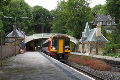
Public Transport Located on both the main A6 road between Derby and Buxton and the Derby to Matlock railway line, Cromford is very easy to get to via public transport. Probably the quickest, easiest and cheapest way to get to our walks starting in Cromford is by train. These are operated by East Midlands Railway, and run hourly in each direction between Matlock and Newark via Belper, Derby and Nottingham (every two hours on Sundays and Bank Holidays). Cromford Station is located around five minutes walk from Cromford Meadows and the Canal Wharf, where both of our Cromford-based walks begin from, and the adjacent Cromford Mill, where our village walk ends. The trains also call at Ambergate Station, making them ideal for a return home at the end of a walk along the Cromford Canal. Cromford is also served by a number of bus services. The two main ones are the Trent Barton "Sixes" 6.1 service between Derby and Bakewell, and the High Peak Buses "Transpeak" service between Derby and Buxton. Other bus services through Cromford provide access to and from other destinations including Ashbourne, Alfreton, Ripley and Crich. The Trent Barton 6.1 service runs hourly between Derby, Belper, Wirksworth, Cromford, Matlock and Bakewell, calling in the village of Cromford at the Market Place. From there, it is a short walk of about 5-10 minutes to the start point of your walk. This bus can also be used to return home at the end of a village walk, but cannot be used to return home from the end of a walk along the Cromford Canal as it does not call at Ambergate. The High Peak Buses "Transpeak" is a semi-fast service along the A6, running hourly between Derby and Buxton. As a semi-fast service following a shorter route, it is much quicker than using the Trent Barton 6.1, but also more expensive. In Cromford, it calls at stops located either side of the traffic lights at Cromford Crossroads. From these stops, it is a short five-minute walk to the start point of your walk. As the "Transpeak" also calls at Ambergate, it can also be used for a return home at the end of a walk along the Cromford Canal. Other buses through Cromford include the Littles 140 and 141 services, which run between Matlock, Crich, Ripley and Alfreton, and the Hulleys of Baslow 110 and 111 services between Matlock, Wirksworth and Ashbourne. The Derbyshire Wayfarer day rover ticket is valid on all trains after 9:00am on weekdays (any time at weekends and Bank Holidays), and at all times on all buses via Cromford. More information on the validity of the Derbyshire Wayfarer ticket can be found here. However, it may be cheaper to buy individual fares for each journey unless you are travelling a significant distance. Car parking in Cromford There are three pay-and-display car parks located very close to the start points of our Cromford-based walks. These can be found at Cromford Canal Wharf, Cromford Mill and Cromford Meadows. All three of these are just a couple of minutes walk at most from the start points of our walks, and provide plenty of spaces even on busy days, so you should have no trouble finding somewhere to park. If you are doing one of our Cromford Canal walks, then we recommend that you park in the pay-and-display car park at Ambergate Station, and take the train or bus from there to Cromford. This saves you having to hang around at Ambergate for up to an hour waiting for the train or bus back to Cromford to collect your car from there. |
|
|
|
Walks Beginning/Ending In Edale
|
|
Public Transport As it is located on the "Hope Valley Line" between the two cities, the village of Edale is easily accessible by train from both Sheffield and Manchester. As both of these cities have good connections to the surrounding area, it can also be accessed from many other towns and cities including Derby, Nottingham, Buxton, Chesterfield and Matlock. Trains to Edale run hourly at weekends, and every two hours on weekdays, and the station at Edale is located just a couple of minutes walk from the start and end point of our Edale walks. There are no scheduled bus services to and from Edale, and it is not covered by any demand-responsive "dial-a-bus" services. As Edale is within the areas covered by both the Derbyshire Wayfarer and Greater Manchester Wayfarer day rover tickets, it is possible to use either of these to access walks beginning and ending there. Both may be used on any train services to and from the village at weekends and on Bank Holidays. On weekdays, the Derbyshire Wayfarer may also be used on the early train from Sheffield to Edale for a 10:30am start, while weekday validity of the Greater Manchester Wayfarer does not begin until 9:30am, which is too late to use on a train to Edale for a 10:30am start. Car parking in Edale Parking in Edale is quite limited and very popular. This means that it can be difficult to find a parking space unless you are prepared to arrive early. Edale has one main pay-and-display car park by the entrance to the village (138 spaces), plus a smaller 20-space pay-and-display car park at Edale Station. Due to the narrow roads though the village, parking in the village itself is not possible. If you are planning on driving to your walk, we recommend that you plan to arrive in Edale no later than 10:00am, especially at weekends or on Bank Holidays. Due to the narrow roads around Edale, which most sat-navs and online route planners do not take into account, we recommend that you follow the route included in the walk informtion sheet you will be sent when you book, as this takes the narrow roads into account. |
|
|
|
Walks Beginning/Ending In Miller's Dale Or Wyedale
|
|
Public Transport By far the easiest way to access our walks starting at either Miller's Dale Station or Wyedale Car Park is to take the bus from Buxton Market Place or Railway Station. This takes approximately seven minutes to Topley Pike, and fourteen minutes to Miller's Dale. The stop at Topley Pike is a minute's walk from Wyedale Car Park. For Miller's Dale, get off at the stop at the junction with Wormhill Road. From there, Miller's Dale Station is a short walk up a reasonably steep hill from the bus stop. Please note that, given the distance the bus has to come from Sheffield to Buxton, the number 65 is somewhat notorious for running late, with delays of 20 minutes or more at times. If you are waiting for the bus in Buxton and it appears to be running late, please call the emergency contact number given in your walk information to let your guide know. Although bus times do change, the current times for the number 65 service from Buxton means that it is not really an option for a 10:30am start from Miller's Dale. Therefore, we do not recommend that you use it for such a walk if you are travelling from or via Buxton. If traveling from further afield, you can get to Buxton by any of the means described above, and then change to the 65 bus for onwards travel to Wyedale or Miller's Dale. Both Wyedale Car park and Miller's Dale are very easy to access from Sheffield, as they are both on the route of the direct number 65 bus services to Buxton. If travelling from Chesterfield, the withdrawal of the direct number 66 bus service from Chesterfield to Buxton means that the best option is to travel via Sheffield on the number 65 bus as described above. Other options do exist for using the bus to get to Wyedale Car Park. However, these other options all involve long waits at bus stops alongside very busy roads where there is no shelter, no seating and nothing to do for the 30 minutes or more you would have to wait for your connection onwards to Wyedale Car Park. For this reason, we do not recommend these as really viable routes. For walks finishing at Miller's Dale, you can then use the Stagecoach Chesterfield number 65 service to return to Buxton or Sheffield. However, as these only run every couple of hours (at best), they are not an option that we usually recommend. Journey time into Buxton is approximately 15 minutes. For onwards travel from Buxton, you can then take the "Transpeak" southwards to Bakewell, Matlock, Belper and Derby, or one of the regular trains from Buxton to Manchester. To return to Chesterfield, your best option is to take the number 65 bus into Buxton as detailed above, and then take the "Transpeak" to Bakewell. There, you should change to the Hulleys of Baslow 170 or X70 service for onwards travel to Chesterfield. The Derbyshire Wayfarer day rover ticket is valid on all of the buses listed above. More information on the validity of the Derbyshire Wayfarer ticket can be found here. If travelling from Manchester, it is possible to use the Greater Manchester Wayfarer day rover ticket on all bus and train services to and from Buxton and Manchester, including the buses out to Miller's Dale and Wyedale. Car Parking at Miller's Dale and Wyedale It is possible to access both Miller's Dale and Wyedale by car. Pay-and-display car parking is available at both Miller's Dale Station (80 spaces) and Wyedale Car Park (28 spaces). However, Wyedale Car Park is very popular, especially with local fishermen on the River Wye, and so it can be very difficult to find a space there at weekends and Bank Holidays. For this reason, we usually recommend that you park elsewhere and use the bus to get to walks beginning from Wyedale Car Park. While it is possible to use the bus to return to Miller's Dale or Wyedale to collect your car at the end of a walk, this can be difficult and time-consuming due to the low frequency of buses. For this reason, for Monsal Trail walks from either Wyedale or Miller's Dale to Bakewell, we always recommend that you park in Bakewell and use the "Transpeak" and 65 bus services to get to the start point of your walk. |
|
|
|
Walks Beginning/Ending In Taddington
|
|
Public Transport Although accessible by public transport, Taddington is only served by one regular bus service, the hourly High Peak Buses "Transpeak" service between Derby and Buxton. Taddington can also be accessed from Chesterfield and Sheffield by changing buses at Bakewell, or from Manchester by taking the train to Buxton and changing to the bus there. At the end of a walk finishing in Taddington, you can then use the "Transpeak" to return home, with hourly southbound departures towards Derby and hourly northbound departures towards Buxton. The Derbyshire Wayfarer day rover ticket is valid on all of the buses listed above. More information on the validity of the Derbyshire Wayfarer ticket can be found here. If travelling from Manchester, it is possible to use the Greater Manchester Wayfarer day rover ticket on all bus and train services to and from Buxton and Taddington. Car Parking in Taddington Taddington has no public car parking at all. The only way to park within the village is to park on the road through the village, which is not recommended due to its narrowness and the need to allow access through the village for the buses and other vehicles. The closest public car park is the pay-and-display car park on the A6 at White Lodge, a couple of miles south of the village at the bottom end of Taddington Dale. If you park here, you can then take the "Transpeak" from the stop outside the car park into Taddington, and then back to the car park at the end of your walk. Other car parking is available in Buxton and Bakewell, from where you can also use the "Transpeak" to get to and from Taddington for your walk. |
|
|
|
Derbyshire Wayfarer validity
|
|
The Derbyshire Wayfarer day rover ticket allows virtually unlimited travel around Derbyshire. It is valid on the majority of bus services operating within the county of Derbyshire, and can be used on these services at any time of day or night. It is also valid on train services within the county for journeys beginning after 9:00am on weekdays, or at any time of day on weekends and Bank Holidays. It can also be used on a number of bus and train services to and from destinations located outside the county. The ticket is valid on bus services operated within Derbyshire by the following companies: Arriva Midlands, Ashbourne CT 'Derbyshire Connect', D&G, First, G & J Holmes, High Peak, Hulleys of Baslow, Kinchbus, Little's Travel, Midland Classic, Notts & Derby, Stagecoach, TM Travel, Trent Barton, Warringtons. In addition to services entirely within the county of Derbyshire, the ticket can also be used on services between Derbyshire and the following locations: Sheffield (city centre), Macclesfield (town centre), Leek (town centre), Burton-on-Trent (town centre) and Uttoxeter (town centre). The ticket can't be used on local buses within Sheffield, Macclesfield, Leek, Burton-on-Trent or Uttoxeter, but does allow travel to or from any of these locations on direct services to or from any location in Derbyshire. The ticket is also valid within Staffordshire on Services 441 and 442, within Nottinghamshire on Service 15 (Ilkeston - Sawley), between Derbyshire and East Midlands Airport on Services SKY (Skylink and Skylink Nottingham), and between Glossop and Holmfirth on Service 351. It may also be used between any stations on the following train routes after 9:00am on weekdays, and at any time on weekends and Bank Holidays:
The ticket can be used on the above lines on trains operated by Cross Country Trains, East Midlands Railway, Northern Trains and TransPennine Express. Please note that the ticket is not valid to or from East Midlands Parkway. A map showing the area within which the Derbyshire Wayfarer ticket is valid is available from Derbyshire County Council here. The latest information on the price of a Derbyshire Wayfarer, where to purchase it in advance or on the day of travel, and the discounts at visitor attractions you can get by using a Derbyshire Wayfarer can be found here. |
|
|

|

|